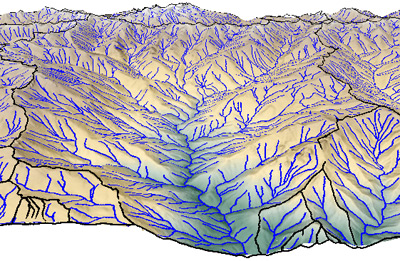
Flowpaths and watershed boundaries in perspective view
The Watershed process in TNTmips models the movement of water over the land surface. Using the digital elevation model (DEM) raster object you select, the process divides the terrain into separate watersheds and determines the stream network for each. Watersheds can also be divided into basins (subwatersheds) associated with particular branches of the stream network. Several geomorphic indices can be computed for the terrain surface and hydologic attributes can be determined for the stream lines and basin polygons. The geospatial products created by the watershed process can be used for environmental analysis and as input for more specialized hydrologic and geomorphic modeling such as soil erosion models.
See also:
Tech Guides on Watershed Analysis and
Modeling Watershed Geomorphology tutorial

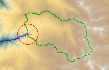
flowpath and basin from seed point

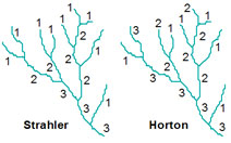
computed stream orders

Watershed Analysis Highlights
- Fast, efficient processing of very large DEMs (gigabytes in size)
- Compute vector flowpaths, watersheds, basins, and ridge lines
- Control drainage network density and basin size using flow accumulation thresholds for outlet, upstream limit, and branching points
- Quickly recompute and save multiple versions of flowpaths and basins using different criteria
- Automatically fill spurious small depressions in DEM and set thresholds to leave larger/deeper depressions unfilled
- Automatically place a drain (null cell) in bottom of unfilled depressions to model their internal drainage
- Compute upstream catchment area and downstream flowpath for specific locations by manually placing seed points in a view of the DEM or by loading them from a vector geodata layer
- Save Watershed results at any time
- Compute hydrologic/geomorphic characteristics of the DEM cells: specific catchment area, compound topographic index (CTI), maximum upstream flow distance, and downstream flow distance
- Compute hydrologic attributes of flowpaths: stream order, elevation drop, average slope, sinuosity ratio, upstream and downstream flow distances, and others
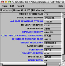
- Compute hydrologic attributes of catchment polygons: drainage density, basin length, elongation ratio, basin relief, mean stream slope, and many others
- Created segmented flowpath network using elevation or flow accumulation values
