GeoToolbox
Technical Guides & other documentation
GeoToolbox
Tutorial: Sketching & Measuring
(28 pp)
Combining Regions
Regions from Group, Layer, and View Extents
Use Active/Marked Elements for Measurement, Sketch, and ...
(2 pp)
Analyze Raster and Web Terrain Profiles
Graph Values from Multiple Rasters/Terrains by Location
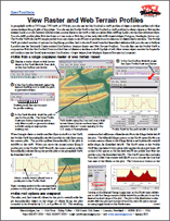
View Raster and Web Terrain Profiles
Points, Multi-Points, and Options
Erasing Portions of Lines and Polygons
Create Regions by Selection
Create Regions Using Raster Expressions
Create Regions by Thresholding
Interactive Region Analysis
Update Raster Histograms
Show/Hide Areas of Interest
Cross Sections with Styles
Enhanced Sketch Annotation
GeoToolbox
Profile Views
Toolbox Measurements and Regions
Tutorial: Sketching & Measuring
Combining Regions
Regions from Group, Layer, and View Extents
Use Active/Marked Elements for Measurement, Sketch, and ...
Analyze Raster and Web Terrain Profiles
Graph Values from Multiple Rasters/Terrains by Location
View Raster and Web Terrain Profiles
Points, Multi-Points, and Options
Erasing Portions of Lines and Polygons
Create Regions by Selection
Create Regions Using Raster Expressions
Create Regions by Thresholding
Interactive Region Analysis
Update Raster Histograms
Show/Hide Areas of Interest
Cross Sections with Styles
Enhanced Sketch Annotation
GeoToolbox
Profile Views
Toolbox Measurements and Regions