LIDAR points colored by class and as virtual surface
LIDAR point clouds containing millions of elevation points can be viewed, classified, and analyzed in TNTmips directly in their efficient LAS file format. Use the LIDAR Manager to link, merge, tile, reproject or extract from LAS point clouds. Tiled LIDAR files can be defined as a single seamless LIDAR dataset for ease of display and use. Use the LIDAR Classification process to detect and flag noise points and to identify points on the ground surface. Many flexible options are provided to Display LAS point clouds, including selection of points by class or return type and styling of points by class, elevation, return type, or intensity. View a LIDAR point cloud as a virtual terrain surface with relief shading, colored by elevation, or both, with full control of point classes used to generate the surface.
See also:
Tech Guides on LIDAR.
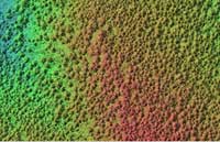
Virtual terrain display, all points
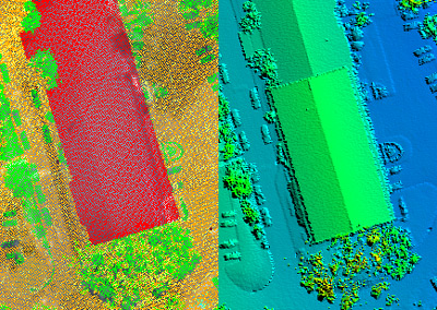
Virtual terrain display, ground points classified in TNTmips
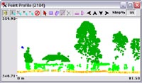
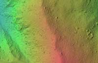
Vertical point profile
LIDAR Highlights
- Display, classify, and analyze LIDAR point clouds with tens of milions of points in efficient LAS file format
- Use LIDAR Manager to merge, tile, or reproject LAS point clouds and extract by area and/or by class
- Create and use tiled LAS files as single seamless dataset
- Automatically detect and classify high and low noise points
- Classify ground points by terrain-following or multiscale curvature methods
- Specify set of classes to be available and manually reassign entire classes if needed
- Select LIDAR points for display by class, return type, intensity, scan angle, or a combination of criteria
- Style LIDAR points by class, elevation, return type, or intensity
- Style LIDAR points by current or previous class assignments and view summary of class changes to evaluate automatic classification results
- View LIDAR cloud as virtual terrain surface with relief shading, colored by elevation, or both
- Select points by return type or point class (current or previous) to use for virtual terrain surface
- Adjust illumination direction used for shaded virtual terrain surface
- View vertical profile of 3D points within rectangular swath drawn as a box within the view
- Rotate, expand, move, or redraw the profile box as needed and set fixed or range-dependent vertical scale for profile
- Select points in the profile view for manual reclassification