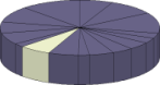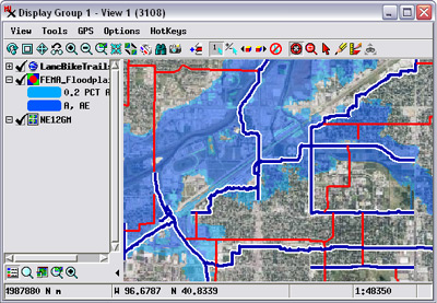
Web tileset, shapefile polygons, and KML lines
Geospatial data in many file formats can be viewed and used directly in TNTgis software without requiring import. Dozens of raster and geometric file formats can be used in their native form while fully supporting image enhancements and the creation of new attribute information and display styles. You can also manually link to, import from, or export to an even wider array of geospatial data, web tileset, and database formats. The Display process also allows you to render views directly to several popular image formats and to standard web tilesets. Styled geometric data in view also can be rendered to tilesets and KML files, and complex map layouts to PDF files for easy distribution of digital maps.
See also:
Tech Guides on Geodata Formats and
Geodata Format Summary Table.
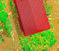
LIDAR point display from LAS file
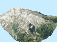
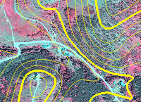
Color-infrared orthoimage from 4-band JP2 and contours from File Geodatabase

Complex map layout rendered to PDF
Geodata Formats Highlights
- Display, enhance, and use images in JP2/GeoJP2, TIFF/GeoTIFF, JPEG, PNG, NetCDF, NITF, ERDAS Imagine, PCI, and other formats
- Display, enhance, and use elevation data in ArcGrid format
- Display, attribute, and style map data in shapefile, ESRI File Geodatabase, AutoCAD DWG/DXF, Geomedia MDB, KML and other formats
- Use standard web tilesets as reference images
- Display, classify, and process LIDAR point data in the standard LAS format
- Link files automatically store supporting data such as styles, histograms, pyramid tiers, and spatial indexes
Import or link to geospatial data and database information
- Link to map and attribute data in enterprise databases (Oracle, MySQL, Postgres/PostGIS, SQLserver)
- Import image, elevation, and other raster data from DEM, HDF, ENVI, ASTER-HDF, MODIS-HDF, PALSAR, and dozens of other formats
- Import hyperspectral images from AVIRIS and ENVI formats
- Import geometric map data with attributes from ArcE00, Caris, DLG, TIGER, and dozens of other formats
- Import georeference control points from GPS files
- Specify custom formats for binary image data and text-based map data
Export and render geospatial data
- Export image and map data to dozens of file formats
- Export map data to spatial databases (Oracle, MySQL, PostGIS)
- Render view to JP2/GeoJP2, TIFF/GeoTIFF, JPEG, or PNG image
- Render image and map data in view to KML or SVG
- Render image and map data in view to Google Maps or Google Earth standard web tileset
- Export styled vector map data to KML or SVG geometric web tileset
- Render complete complex map layouts to PDF with embedded georeference information