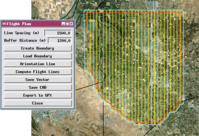
Interactive script to generate parallel flight lines
Batch processing via the TNTmips Job Processing system allows scheduling processes to run at any convenient time. Multiple jobs can be run simultaneously to exploit your computer's multiple processor cores. The TNTmips geospatial scripting language (SML) provides a wide range of options for custom display and processing of your geospatial data. You can implement novel new processes with dialogs, Views, and custom tools, or automate workflows through a chain of processes. You can add interactive tools and enhancements to standard Views so you can use or transform the displayed layers. Thousands of built-in functions, integrated documentation, and hundreds of sample scripts make it easy to learn how to use these powerful tools.
See also:
Tech Guides on Scripting,
Tech Guides on Job Processing,
Scripting tutorials, and
Sample Scripts.
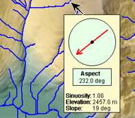
Custom DataTip with graphic
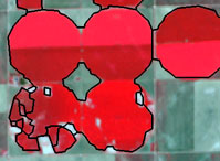
Polygons from object-finding script
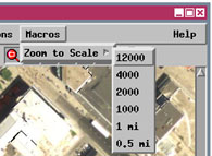
Custom menu in View
Batch / Custom Processing Highlights
- Use TNTmips Job Processing to set up batch processing and run multiple process jobs simultaneously in separate threads/cores
- Schedule jobs to run at any convenient time
- Job Manager provides control of job queue and scheduling
- Geospatial scripting language (SML) can read, modify, and create geospatial data and attribute information for raster, vector, CAD, shape, and TIN
- Use simplified interactive Geoformula dialog to compute virtual display layers from one or more geodata layers
- Create custom standalone processes and automate complex batch processes
- Set up macro scripts with menu options to process geospatial data in a View
- Create interactive tools to select and process geospatial data in a View
- Use a display control script to add custom text and graphics to DataTips to automatically provide rich attribute information for layers in a view
- Write queries using any combination of attributes from relational databases to select geospatial elements for display, editing, or processing
- Design custom point and line symbols for geometric objects using cartographic rendering scripts (CartoScripts)
- Thousands of built-in functions and classes provide access to compiled internal TNTmips procedures for fast efficient processing
- Image processing pipeline classes for easy assembly of multistep processing streams that can be designed in graphical Script Builder
- Script Editor with syntax checking, color syntax highlighting, and built-in error messages
- Integrated documentation and hundreds of annotated sample scripts
- Define and add your own functions and procedures with local or global variables
- Create custom dialogs for your scripts using simple XML dialog specification